Two storms in two weeks: El Niño has taken down Hawaii’s hurricane force field

Daftar Isi
Hawaii Faces a Second Tropical Storm in Two Weeks as El Niño Disrupts the Pacific’s Natural Shield
Activelifezero.com – Residents of the Hawaiian Islands are bracing for another round of heavy rain and gusty winds as Tropical Storm Moke tracks toward the archipelago — the second significant tropical system to threaten the islands within a single fortnight. As of 5 a.m. ET on the morning of the latest advisory, Moke sat roughly 545 miles southeast of Hilo on the Big Island, packing maximum sustained winds of 45 mph and drifting west-northwest at about 8 miles per hour. Forecasters expect the system to hold its tropical-storm classification through its closest approach, with the eye passing well south of the Big Island. Even so, the outer bands are close enough to deliver sustained downpours and damaging wind gusts to communities still patching up roads, clearing debris, and restoring power lines after last week’s ordeal.
What Lala Left Behind
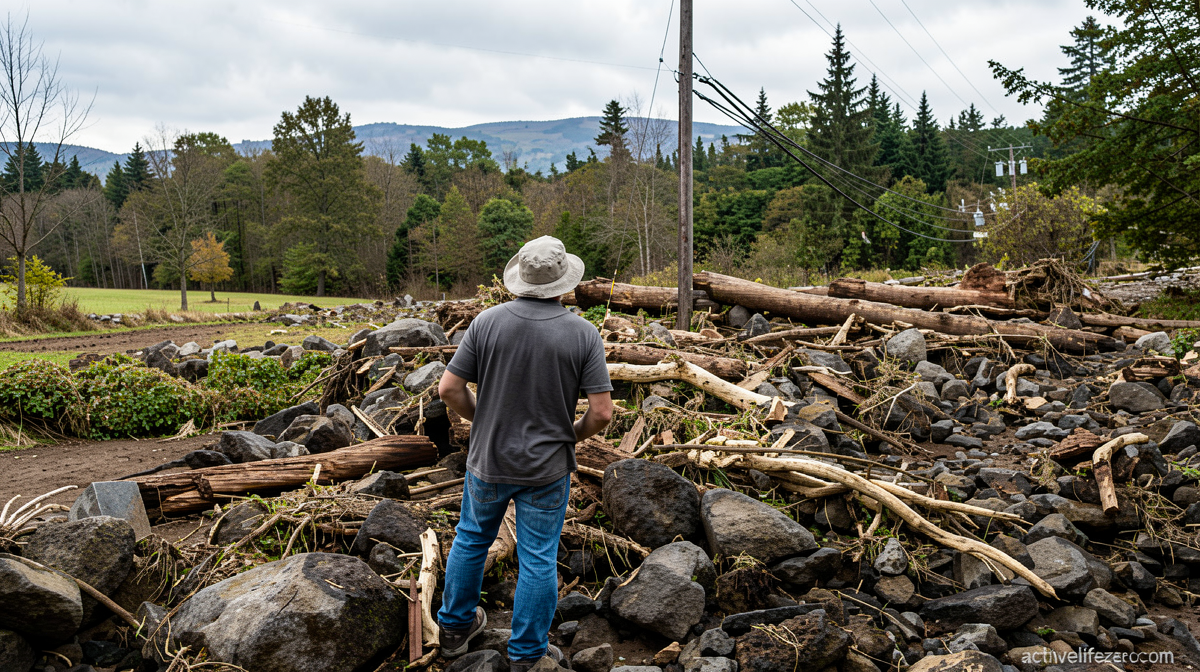
Just seven days earlier, Hurricane Lala spun up in the waters south of the Big Island and unleashed a torrent of rainfall exceeding three feet in places along the island’s windward slopes. The deluge triggered cascading landslides and flash floods that severed access roads to small coastal and upland communities, leveled residential structures, and knocked out segments of critical infrastructure including water mains and electrical feeders. At least one death has been attributed to the storm’s effects. For a population accustomed to tropical weather as a distant curiosity, the scale of disruption was jarring and underscored how quickly a single system can overwhelm island logistics.
The El Niño Mechanism: Why the Shield Has Failed
In most years, Hawaii enjoys what meteorologists have likened to an anti-hurricane force field. Pacific hurricanes that drift west or northwest toward the islands typically encounter progressively cooler sea-surface temperatures and increasingly hostile upper-level wind shear as they near the archipelago. Because tropical cyclones draw their energy from warm ocean water and weaken sharply when surrounded by strong vertical wind shear, most storms that approach Hawaii lose intensity before reaching the islands. The result has been decades of near-total immunity from direct hurricane impacts.
The developing Super El Niño event is dismantling that protection on two fronts simultaneously. Warmer-than-normal sea-surface temperatures now extend across the eastern and central tropical Pacific — precisely the corridor where storms form and track toward Hawaii — and also along the southern approaches to the islands. With the fuel supply no longer tapering off as a storm closes in, systems retain their strength far longer than climatological norms would suggest. At the same time, the altered upper-level wind patterns associated with El Niño reduce the shear that would otherwise erode a storm’s structure before landfall.
A Landfall Streak That Nearly Broke
Hurricane Lala came close enough to the Big Island that its center skirted just offshore of the island’s southern tip. Had the track shifted even slightly northward, the state would have broken a remarkable streak: zero hurricane landfalls since Category 4 Hurricane Iniki struck Kauai from the southwest in September 1992. That nearly three-decade gap made the near-miss all the more alarming for residents and emergency managers alike. Lala demonstrated, however, that a storm need not touch down to inflict catastrophic damage; its outer rainbands were sufficient to produce the worst flooding and landslide activity in years.
What the Forecaster Says
Matthew Rosencrans, the lead hurricane season forecaster at the National Weather Service, emphasized that even during pronounced El Niño seasons, storms closing within 300 nautical miles of the Hawaiian Islands remain uncommon. The climatological average, he noted, is roughly one such close approach per season. With Moke now on track, Hawaii will have experienced twice its typical annual frequency of nearby tropical cyclones — and Rosencrans indicated that a third close pass is probable before the season winds down.
“Very bizarre,” he described the two-week window in which two storms have sequentially threatened the islands, attributing the unusual clustering to a temporary alignment of atmospheric steering currents that channeled both systems toward Hawaii’s direction.
He cautioned that such steering patterns can shift rapidly, potentially offering the islands a reprieve in the coming weeks. The episode fits a broader El Niño tendency: it raises the probability of certain linked outcomes — more storms forming in the eastern and central tropical Pacific, more of them tracking near Hawaii — without guaranteeing that every individual storm will reach hurricane intensity.
The Atlantic Contrast
The same El Niño signal that is amplifying Pacific activity is suppressing the Atlantic basin. Enhanced upper-level winds over the tropical Atlantic tend to tear apart nascent disturbances before they can organize, and the Atlantic has been conspicuously quiet for weeks. This seesaw effect between basins is a well-documented feature of El Niño years and explains why Pacific residents face elevated risk while Atlantic coastal communities enjoy an unusually calm season.
What Comes Next for Island Communities
For Hawaii’s residents, the practical takeaway is straightforward: the protective climatic buffer that has kept the islands largely untouched by direct hurricane impacts for over three decades is temporarily offline. Emergency managers, utility crews, and residents who cleared debris after Lala now face the prospect of renewed rainfall and wind events while recovery work is still underway. Road closures, landslide-prone slopes, and strained municipal resources mean that even a tropical-storm-strength system passing south of the islands can compound existing vulnerabilities. Meteorologists advise that the steering-current alignment responsible for this fortnight’s double threat may not persist, but until it does, the islands should plan for continued elevated tropical-weather risk through the remainder of the season.
Related Reading
Frequently Asked Questions
What is Two storms in two weeks?
Two storms in two weeks is the main topic of this guide. The article explains the context, practical details, and next steps readers should understand.
Why does Two storms in two weeks matter?
Two storms in two weeks matters because readers are looking for a useful answer, not just a short summary. Good content should match search intent and help them decide what to do next.