El Niño will upend winter weather in the US. Here’s who will feel it the most

El Niño Will Upend Winter: Who Feels It Most
Activelifezero.com – El Niño will upend winter weather across the contiguous United States, and the atmospheric setup is already taking shape. A rapidly intensifying Pacific warming event — one that forecasters expect to reach Super El Niño status no later than October — is poised to become the dominant driver of cold-season conditions. By year-end, models assign roughly a 70 percent probability that this episode will surpass every oscillation previously recorded, making it the most powerful manifestation of the phenomenon in the instrumental era.
The stakes are not merely academic. When sea-surface temperatures along the equatorial Pacific run well above their long-term averages, the resulting warmth reorganizes atmospheric circulation in a cascading fashion: storm tracks shift, precipitation zones migrate, and temperature distributions tilt across entire continents. The stronger the event, the more reliably those textbook patterns tend to materialize.
“Something that’s very unusual, if not a once in a lifetime type of (strength),” Nat Johnson, a meteorologist at NOAA’s Geophysical Fluid Dynamics Laboratory, described the current episode’s trajectory.
Still, NOAA is careful to stress that a historically powerful oscillation does not guarantee historically extreme weather. It tilts probabilities. The distinction matters: a 70 percent chance of record strength is extraordinary, but it remains a probability distribution, not a certainty.
How the Jet Stream Gets Rewired
The central mechanism is straightforward. The Pacific warming typically displaces the polar jet stream — the high-altitude ribbon of fast-flowing air through which mid-latitude storms travel — southward from its climatological position, pulling it into the southern tier of the United States. The downstream consequences are regional and asymmetric.
In the northern states, the jet’s southward shift leaves a broader, more persistent ridge of high pressure overhead. The result is drier air, reduced storm frequency, and temperatures running above seasonal norms. For residents of the Pacific Northwest through the Midwest, that means a winter that skews warmer and less snowy than average. Northeasterners who track snowfall totals should note that strong El Niño winters historically deliver below-average snowfall to that region.
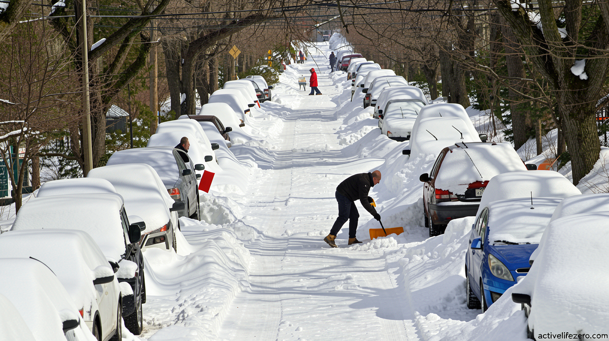
The picture inverts for the Southeast and portions of the southern Plains. Cooler air masses, combined with enhanced moisture transport from the Gulf of Mexico, create conditions favorable to snow, sleet, and freezing rain. How disruptive those events become depends ultimately on how far temperatures dip below freezing thresholds — a variable the oscillation alone cannot dictate.
Thunderstorm Risk Along the Gulf
Winter severe thunderstorms, which normally taper after their spring peak, tend to rekindle along the Gulf Coast from late autumn into early winter. The Pacific warming amplifies that signal unevenly. Florida sits at elevated risk for winter convective events during strong phases, while other stretches of the Gulf Coast experience below-normal activity. Michael Tippett, a climate scientist at Columbia University, has noted this geographic split in convective risk.
What the Forecasts Already Show
NOAA’s Climate Prediction Center publishes seasonal outlooks months in advance, and the December-through-February maps for both temperature and precipitation carry unmistakable signatures of the current event. The highest probabilities for above-average warmth stretch across the entire northern tier — from the Pacific Northwest through the Upper Midwest — consistent with the jet-stream displacement described above. Warmer-than-normal conditions are plausible over more than half of the Lower 48.
On the precipitation side, wetter-than-normal weather is possible across a broad swath of the country, including Southern California, the full southern tier, and portions of the East Coast. Model confidence is strongest over the Southeast, where the combination of moisture and cooler air makes above-average rainfall and ice events the leading scenario. Drier-than-normal conditions, where they appear, are confined to the northern tier — the same belt forecast to run hotter. Hot and dry, by definition, is not a snow-producing combination.
The Warming Backdrop
The oscillation does not operate in a vacuum. A climate already warming from fossil-fuel emissions sets the baseline against which every seasonal anomaly is measured. An analysis by the non-profit research organization Climate Central found that winter is now the fastest-warming season for most of the United States, meaning that even a “normal” winter arrives on a warmer platform than it did three decades ago. That warming has tangible consequences: it compresses the margin between a cold snap and a record-low temperature, and it raises the frequency of days that brush the freezing threshold in regions where snow once fell reliably.
Frequently Asked Questions
When will the event peak? Forecasters project the oscillation reaching its maximum strength between October and December. The exact timing shifts with model updates, but the broad window is consistent across NOAA, ECMWF, and private-sector ensembles.
Will my region get more or less snow? Northern-tier residents (Pacific Northwest through Upper Midwest) should expect below-average snowfall and above-average warmth. Southeast and southern-Plains residents face elevated odds of snow, sleet, or freezing-rain events, though the severity of any single storm depends on local temperature margins.
Does a record-strength event mean record-breaking weather? No. It shifts the probability distribution. A 70 percent chance of record strength is extraordinary, but individual storms, cold snaps, or heat events remain governed by day-to-day dynamics that no seasonal forecast can resolve.
Where can I track updated outlooks? NOAA’s Climate Prediction Center publishes monthly seasonal outlooks and weekly ENSO updates. State meteorological services translate those signals into localized winter-weather guidance.