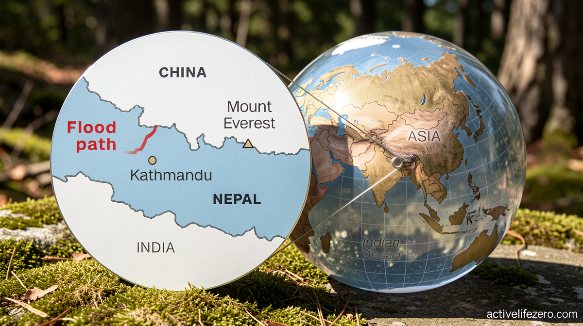
Landslides and floods have wreaked havoc in Nepal and China. Follow the river down the path of destruction.

Daftar Isi
Mountains Give Way: Nepal-China Border Region Faces Devastating Cascade of Landslides and Floods
Activelifezero.com – The Himalayan corridor along the Nepal-China frontier has been battered by a sequence of geological and hydrological disasters that, taken together, constitute one of the most severe natural-catastrophe episodes in recent memory for the region. Beginning with a major slope failure on August 26, the terrain has continued to shed debris, channel water into destructive torrents, and isolate entire communities. At least 675 people have lost their lives in the aftermath, while roughly 3,000 residents remain missing across both the Nepali and Chinese sides of the international boundary.
The initial trigger was a large-scale landslide that tore through a mountain valley, sending rock, soil, and glacial meltwater cascading downstream within minutes. Homes built along narrow ridgelines and riverbanks were buried or swept away. Suspension bridges and road crossings—often the only links between remote villages and the outside world—were carried off their anchor points. In areas where the terrain funnels runoff into confined channels, the resulting flash floods moved with a velocity and volume that left residents little time to react.
A Toll That Continues to Climb
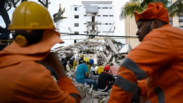
Rescue operations face extraordinary logistical obstacles. Many affected settlements sit at elevations above 3,000 metres, accessible only by footpaths or single-lane mountain roads that have themselves been severed. Helicopter lifts are constrained by cloud cover, wind shear, and the sheer number of people requiring evacuation. On the ground, search teams work through rubble and saturated mud where bodies may be buried under metres of debris. The figure of 675 confirmed deaths is expected to rise as access improves and recovery crews reach previously unreachable pockets of the valley.
The approximately 3,000 unaccounted-for individuals represent families scattered across both sides of the border, some of whom may have been swept downstream into Chinese territory or trapped in collapsed structures. Coordinating search-and-rescue across an international boundary adds a layer of bureaucratic and operational complexity to an already desperate situation. Local authorities on both sides have established joint coordination points, though communication infrastructure—cell towers, landlines, and internet backhaul—has been damaged or destroyed in the worst-hit sectors.
Two Lakes, Two Timed Bombs
Among the most pressing secondary hazards are two lakes that formed in the days following the August 26 event. When a landslide blocks a river or stream, water pools behind the debris dam, creating what engineers call a landslide-dammed lake. These bodies of water are inherently unstable: their walls are composed of loose, unconsolidated material that can erode, overtop, or fail catastrophically. Officials on both sides of the border are monitoring the lakes around the clock, tracking water levels, shoreline movement, and seepage patterns. A sudden breach would release a wall of water downstream, potentially inundating villages that have already been displaced once.
The concern is compounded by the forecast. Additional rainfall is expected over flood-affected areas this weekend, raising the water table, increasing pore pressure within the debris dams, and feeding the very rivers that carved the initial destruction. Meteorological services have issued advisories urging downstream communities to remain on alert and to evacuate preemptively if lake levels rise beyond safe thresholds.
Seeing the Scale from Above
Satellite imagery captured in the days after the event, together with ground-level video recorded by survivors and first responders, reveals the staggering footprint of the disaster. Channels that once carried modest seasonal flows now run wide and turbid, their banks stripped of vegetation. Villages appear as scattered fragments of timber and concrete where orderly clusters of houses once stood. Roads vanish into scree slopes. The contrast between pre-event and post-event imagery underscores how quickly a single slope failure, amplified by monsoon rainfall, can reshape a landscape that took centuries to settle.
Why This Region Is So Vulnerable
The Nepal-China border traverses some of the most geologically active terrain on Earth. The ongoing collision between the Indian and Eurasian tectonic plates keeps the Himalayan range fractured, uplifted, and prone to rockfall and debris flow. Steep gradients mean that even moderate rainfall can initiate shallow slides, while the concentration of meltwater from retreating glaciers adds volume to mountain streams during the summer months. August sits squarely within the South Asian monsoon window, when sustained, heavy precipitation saturates soils and overloads drainage capacity.
Decades of infrastructure development—roads, hydropower projects, and tourism facilities—have altered natural drainage patterns, sometimes concentrating flow into engineered channels that fail under extreme loading. Communities that once adapted to seasonal flooding through elevated construction and flexible land use now face compounded risks as population density in valley floors increases. The current disaster, while driven by natural forces, has exposed how quickly accumulated vulnerability can convert a geological event into a humanitarian catastrophe.
As the weekend rains approach, the focus of relief agencies shifts from initial rescue to sustained protection: reinforcing or bypassing the unstable lakes, clearing debris from critical transport corridors, and ensuring that displaced populations have shelter, clean water, and medical care before the next weather system arrives. The mountains, for now, have spoken. The question for the coming days is whether the response can outrun the next pulse of water.
Related Reading
Frequently Asked Questions
What is Landslides and floods have wreaked havoc?
Landslides and floods have wreaked havoc is the main topic of this guide. The article explains the context, practical details, and next steps readers should understand.
Why does Landslides and floods have wreaked havoc matter?
Landslides and floods have wreaked havoc matters because readers are looking for a useful answer, not just a short summary. Good content should match search intent and help them decide what to do next.