
Tropical Storm Bertha heads for final Gulf landfall as it fuels bigger flooding rain threat in the East
Tropical Storm Bertha Heads for Final Gulf Landfall, Fuels East Flooding
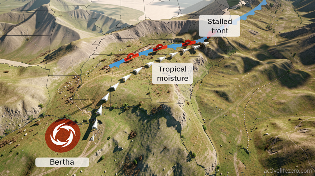
Activelifezero.com – Tropical Storm Bertha heads for final landfall along the northwest Gulf Coast this Thursday, but the greatest danger lies hundreds of miles away. While the system approaches the upper Texas shoreline with sustained winds of 45 mph, its moisture is actively fueling significant rainfall across the Southeast. This disorganized storm, positioned south of Louisiana’s southwestern coast, threatens to deliver more severe flooding to eastern states than to coastal areas.
Heavy Rainfall Threatens the Southeast
A broad cold front stretching from southeast Virginia through the Carolinas and into northern Georgia has become the primary recipient of Bertha’s tropical moisture. This atmospheric setup promises continued soaking rainfall through Friday, potentially creating more severe flooding consequences than those expected near the storm’s center. North Carolina residents have already witnessed remarkable precipitation totals, with certain locations accumulating an entire month’s rainfall within just several days.
Thursday morning’s downpours triggered flash flood alerts across southeast Virginia, eastern North Carolina, and eastern Tennessee, with Interstate 40 experiencing temporary closure northwest of Durham.
Transportation officials reported that the interstate reopened after the worst conditions passed. Meanwhile, north-central North Carolina communities including Greensboro and Winston-Salem received flash flood warnings Wednesday night after storms deposited up to six inches of precipitation over twelve hours. Fortunately, existing drought conditions in that region have helped reduce flood potential despite the heavy precipitation.
Bertha’s Path and Wind Threats
Forecasters anticipate Bertha will maintain tropical storm intensity until reaching the upper Texas coastline late Thursday, followed by dissipation over Texas either Thursday night or Friday. The storm’s asymmetrical configuration means most of its active weather remains concentrated over the Gulf waters. Consequently, tropical storm-force wind gusts will primarily affect the upper Texas Coast and southwest Louisiana, while the majority of precipitation falls toward South Texas.
A tropical storm warning covering sustained winds of 39 miles per hour or higher currently extends from the upper Texas Coast, encompassing Galveston, down to south-central Louisiana. Residents in that zone should expect tropical storm conditions develop Thursday. Further south, portions of the middle Texas Gulf Coast and South Texas may receive between two and four inches of rain, with isolated locations potentially reaching six inches through Thursday night.
Season Context and Extended Outlook
As the Atlantic hurricane season’s second named storm, Bertha arrives during a relatively quiet period compared to recent years. El Niño’s strengthening influence has suppressed storm development across much of the basin. The moisture Bertha carries began moving into a sluggish front over the Southeast and southern Virginia on Wednesday, establishing the foundation for the current flood situation.
Wednesday morning brought flash flooding north of Knoxville, Tennessee, following the delivery of up to five inches of rain within a few hours. Additional precipitation rounds are anticipated through Friday. While southern Virginia and North Carolina desperately need rainfall to alleviate drought conditions, repeated heavy precipitation over the same regions could rapidly generate dangerous flash flooding scenarios.
Weather services have placed a Level 3 of 4 risk for flooding rain across part of the Virginia-North Carolina border from Thursday into Friday morning. Afternoon thunderstorms Thursday could produce rainfall rates approaching two inches per hour, an intensity capable of quickly overwhelming urban drainage infrastructure. Major metropolitan areas including Atlanta, Birmingham, Alabama, and Charlotte, North Carolina face elevated flood risk during this period.
The flooding concern extends through Friday, with a Level 2 of 4 risk covering coastal North Carolina through South Carolina, northern Georgia, and northeast Alabama. Forecast models may upgrade portions of this Level 2 zone to Level 3 as they better pinpoint where the heaviest precipitation will concentrate.
